QGIS Training: Beginner to Advanced Level(Part1/3)

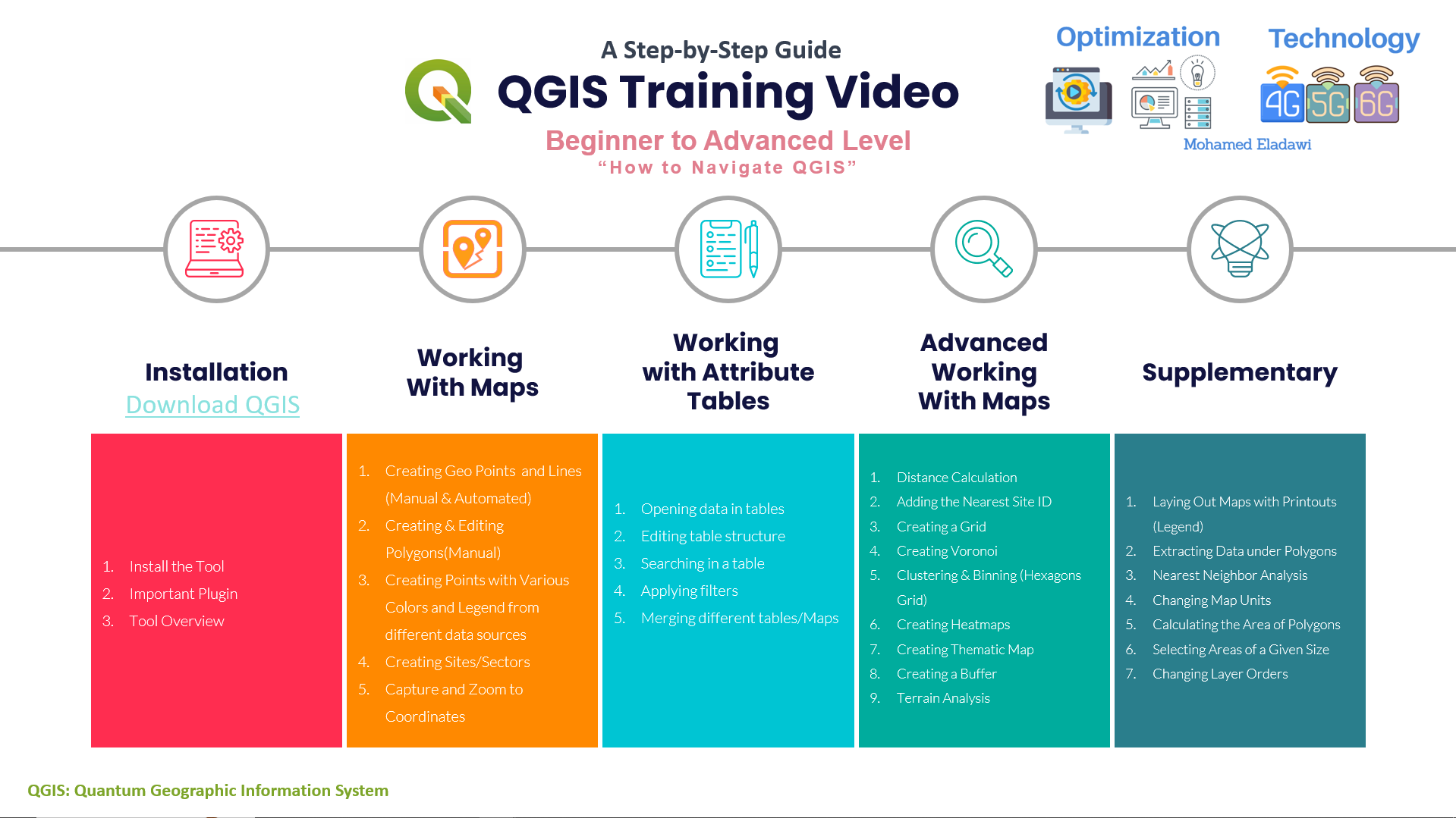
QGIS Training: Beginner to Advanced Level(Part1/2)
Learn and Master QGIS in two Videos
Download QGIS
https://qgis.org/en/site/forusers/download.html
Top important Plugin
1.QuickMapServices
2.QuickOSM
3.Autosaver
4.Coordinate Capture
5.Lat Lon Tools
6.Search Layers
7.Spreadsheet Layers
8.Shape Tools
9.Join multiple lines
10.Azimuth and Distance Calculation
11.Geometry Shapes
12.HCMGIS
Script
Tool Overview about 00:00:00 to 00:11:10
1- Menu Toolbar
2- Panels
Working with Vectors Part 1: 00:11:11 to to 00:35:07
1- Retrieve and upload Google Maps road data and satellite views
2- How to Search and Zoom to Coordinates
3- Creating Geo Points and Lines (Manual & Automated)
4- Creating & Editing Polygons(Manual)
Working with Vectors Part 2: 00:35:08 to 00:54:51
1- How to upload data from different data sources
2- How to create Sectors/Sites
3- Creating Points with Various Colors and Legend from different
4- Hot to apply filter in maps/attribute tables
1- How to get and create routes from the existing Map? 00:55:52 to 01:13:45
2- Adhoc
- How to show Labels?
- How to search for layer/point/etc. in the Map?
- How to add additional/new Maps View?
3- Laying Out Maps with Printouts (Legend)


